Log in
All resources
Create a design
186 Free Artworks of Old Maps Of Spain
bibliothèque nationale de france
maps of spain by tomas lopez
old maps of aragon
1667 maps
1660s maps of spain
atlas maior, vol 10 (spain and africa) - joan blaeu, 1667 - bl 114.h(star).10
copper engraving print
british library
joan blaeu
maps in the rijksmuseum amsterdam
maps of spain by tomas lopez
1774 maps of spain
maps of spain by tomas lopez
1774 maps of spain
1660s maps of spain
1667 maps
1660s maps of spain
1667 maps
1660s maps of spain
1667 maps
1660s maps of spain
1667 maps
1660s maps of spain
1667 maps
1808 in galicia (spain)
galiciana
maps of spain by tomas lopez
1783 maps of spain
maps of spain by tomas lopez
1783 maps of spain
maps of spain by tomas lopez
old maps of extremadura
maps of spain by tomas lopez
old maps of extremadura
maps of spain by tomas lopez
1783 maps of spain
maps of spain by tomas lopez
1783 maps of spain
1660s maps of spain
1667 maps
old maps of castilla la nueva
1765 maps of spain
old maps of the balearic islands
maps of spain by tomas lopez
the loyal west in the times of the rebellion
1803 maps of the united states
maps of spain by tomas lopez
old maps of navarre
maps of spain by tomas lopez
1765 maps of spain
maps of spain by tomas lopez
old maps of navarre
maps of spain by tomas lopez
1766 maps of spain
maps of spain by tomas lopez
1765 maps of spain
maps of spain by tomas lopez
old maps of navarre
maps of spain by tomas lopez
1765 maps of spain
maps of spain by tomas lopez
1765 maps of spain
maps of spain by tomas lopez
old maps of navarre
1660s maps of spain
1667 maps
old maps of asturias
1777 maps of spain
old maps of asturias
1777 maps of spain
old maps of the region of murcia
maps of spain by tomas lopez
old maps of asturias
1777 maps of spain
maps of spain by tomas lopez
1768 maps of spain
maps of spain by tomas lopez
1765 maps of spain
maps of burgos by braun & hogenberg
castillo de burgos
lucas janszoon waghenaer
1580s maps of spain
maps of spain by tomas lopez
1778 maps of spain
maps of spain by tomas lopez
1778 maps of spain
maps in the british museum
jan baptist berterham
vigo in the 18th century
1702 maps of spain
old maps of the stations of the exodus
1650s maps of palestine
old maps of the bahamas
lucayas
maps of spain by tomas lopez
old maps of menorca
old maps of the bay of gibraltar
18th-century maps of gibraltar
barcelona in the 1800s
maps by juan lopez
coats of arms of the kingdom of navarre
coats of arms of the crown of aragon
14th-century illuminated manuscripts from spain
jong (ship)
anthonis van den wijngaerde
historical images of lleida
old maps of trinidad and tobago
17th-century maps of venezuela
maps of the history of morocco
empire of morocco
1750s maps of central america
maps by tomas lopez
old maps of the viceroyalty of new spain
1570s maps of mexico
old maps of el hierro
history of el hierro
toledo, spain in the 17th century
old maps of toledo, spain
maps and topographical views by joris hoefnagel
1580s maps of spain
18th-century maps of central america
1760s maps of the caribbean
nouvelle géographie universelle, vol. xii
old maps of la gomera
old maps of the viceroyalty of new spain
the spanish borderlands
old maps of the strait of gibraltar
hendrik de leth
old maps of st. augustine, florida
john white (colonist and artist)
old maps of la gomera
1878 maps of spain
1680s maps of the iberian peninsula
description de l'universe
siege of hulst 1596
old maps of hulst
hospital de la resurrección, valladolid
alfred guesdon
old maps of the strait of gibraltar
hendrik de leth
atlas geographico del reyno de españa e islas adjacentes (1757)
old maps of asturias
atlas geographico del reyno de españa e islas adjacentes (1757)
old maps of castile and león
atlas geographico del reyno de españa e islas adjacentes (1757)
old maps of aragon
atlas geographico del reyno de españa e islas adjacentes (1757)
old maps of the region of murcia
old maps of lima
joseph mulder
atlas geographico del reyno de españa e islas adjacentes (1757)
old maps of castilla la nueva
atlas geographico del reyno de españa e islas adjacentes (1757)
old maps of castilla la vieja
old maps of seville
baroque
old maps of the kingdom of naples
1700s maps of italy
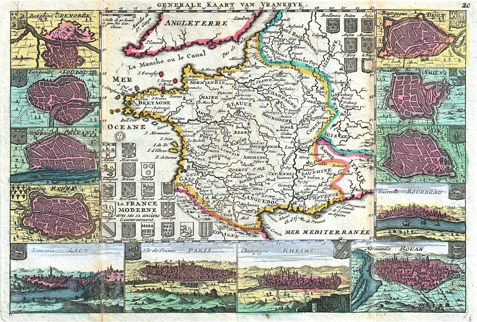
old maps of the history of france
daniel de la feuille
old maps of pyrénées-atlantiques
blanche hennebutte-feillet
old maps of the strait of gibraltar
maps in the rijksmuseum amsterdam
maps in the rijksmuseum amsterdam
maps by willem and johannes blaeu
prints by abraham allard in the rijksmuseum amsterdam
1700s maps of spain
les forces de l'europe, asie, afrique et amerique, ou description des principales villes, avec leurs fortifications
maps in the rijksmuseum amsterdam
maps in the rijksmuseum amsterdam
old maps of algeria
prints by jan luyken in the rijksmuseum amsterdam
maps in the rijksmuseum amsterdam
maps of the captaincy general of cuba
maps of the history of florida
prints by abraham allard in the rijksmuseum amsterdam
1726 maps of spain
thomas onwhyn
britannia
old maps of the viceroyalty of new spain
the spanish borderlands
101 - 186 of 186
/ 2